Primary sources only
Everything is aggregated from National Land Numerical Information, the Hazard Map Portal, J-SHIS and the JMA mesh climate normals. No summary articles, no redistributed copies. Every metric carries its source and retrieval date.
1,892 municipalities · primary sources only
Flood, tsunami, landslide, earthquake probability, land price, climate and distance from major cities for all 1,892 Japanese municipalities, aggregated from primary sources and comparable side by side.
Sources: National Land Numerical Information / Hazard Map Portal / J-SHIS / JMA no composite score, raw values only
No scoring — just the raw values, side by side.
Filter on the left, sort on the right, open any town in place. Nothing sends you back and forth between pages while you compare.
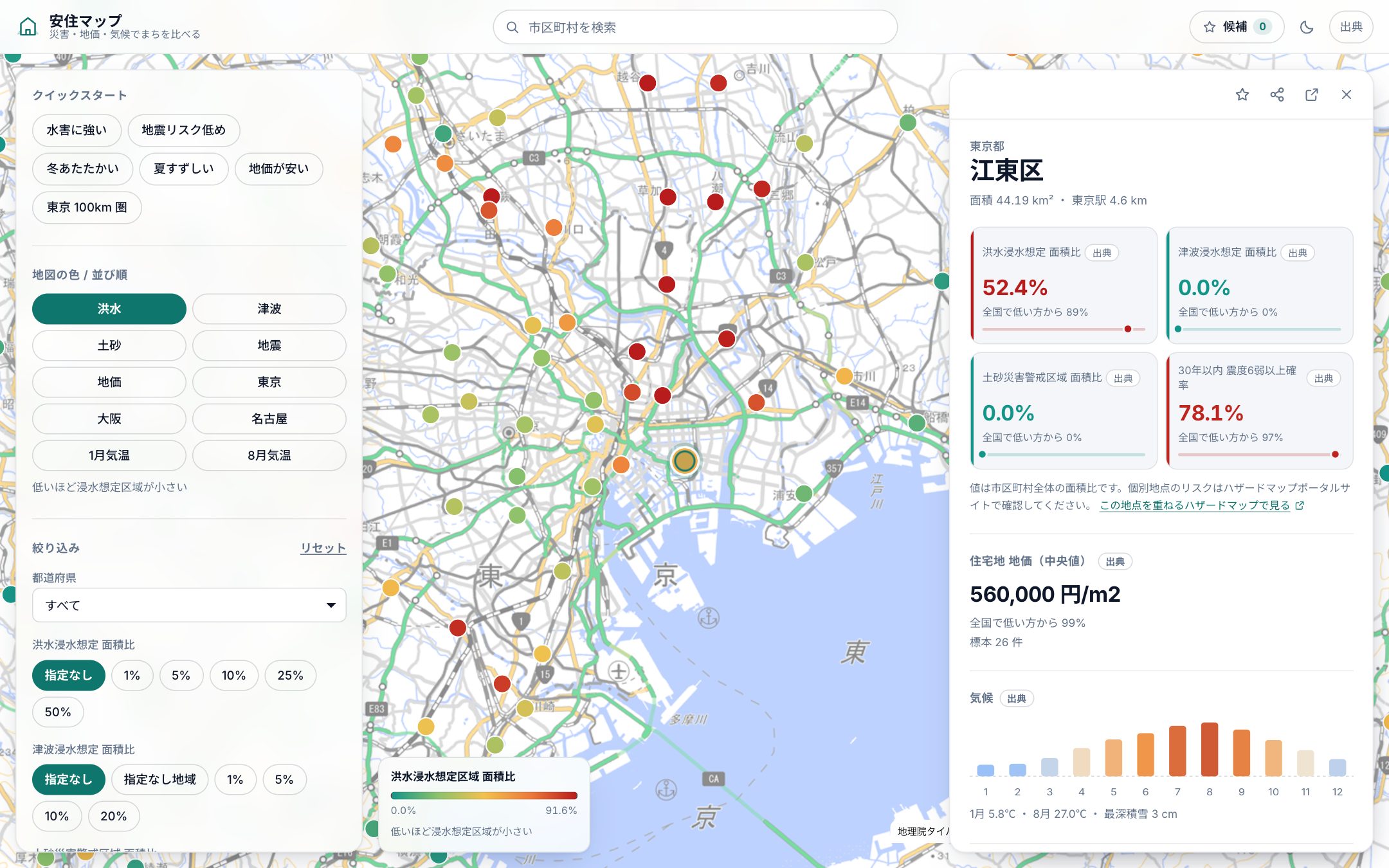
01
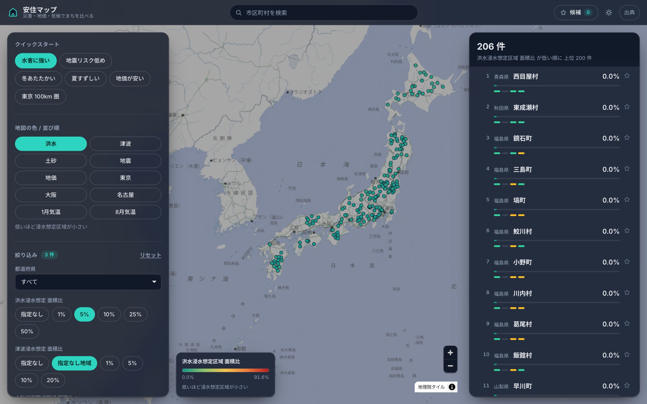
You don't need to know which thresholds are reasonable. Seven quick starts get you going from an intent instead.
02
Colors show the nationwide distribution of the metric you picked. Read the shape on the map, check the ranking in the list; both follow the same filters.
03
Every metric, its source and its nationwide rank on one screen, with a direct link to the municipality's vacant-home (akiya) bank or relocation page.
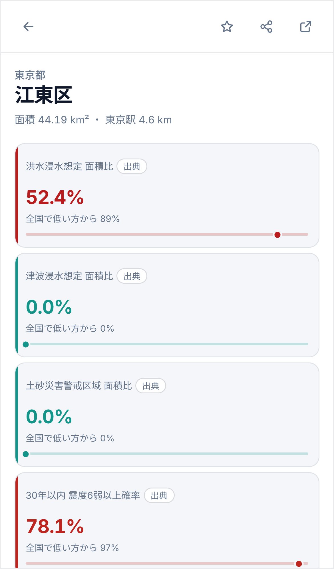
Units and sources are shown as they are, because deciding what to trade off against what is your call, not ours.
The share of the municipality covered by the inundation area expected under the largest assumed rainfall.
Hazard Map Portal
The share covered by the tsunami inundation area. Inland municipalities with no designated area stay null.
Hazard Map Portal
The combined share of the debris-flow and steep-slope-collapse alert areas.
Hazard Map Portal
Taken from the probabilistic seismic hazard map at a representative point such as the town hall.
J-SHIS (NIED)
The median of the residential standard sites in the official land price survey (JPY/m²). Null when there is no sample.
National Land Numerical Information L01
How cold the winter and how hot the summer is, read from the mesh climate normals at a representative point.
JMA mesh climate normals (G02)
The normal maximum snow depth (cm), to gauge how much snow clearing to expect.
JMA mesh climate normals (G02)
Great-circle distance (km) from Tokyo, Osaka and Nagoya stations, so you can choose by how often you commute.
National Land Numerical Information P34
Everything is aggregated from National Land Numerical Information, the Hazard Map Portal, J-SHIS and the JMA mesh climate normals. No summary articles, no redistributed copies. Every metric carries its source and retrieval date.
Where a value could not be obtained we keep it null and record why. “Inland, so no tsunami area is designated” and “not published yet” look like the same blank but mean different things.
Folding hazard risk, land price and temperature into one number requires justifying the weights. We cannot justify them from primary sources, so we do not rank: only raw values and where they sit in the nationwide distribution.
The calculation methods and the disclaimer are collected in Data sources & disclaimer.